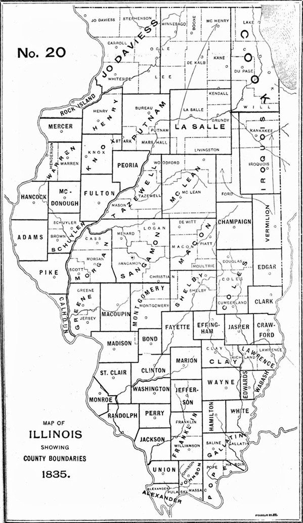
1835 Illinois County Formation Map
Try our genealogy search engine
1835--CHAMPAIGN AND IROQUOIS
As counties of the State of Illinois
1833-1835--CHAMPAIGN AND IROQUOIS
CHAMPAIGN. Feb. 20, 1833--West from the southwest corner of section thirty-four, town sixteen north, fourteen west of the second principal meridian to the east line of Macon; thence north to the line between towns twenty-two and twenty-three north; thence east to the northwest corner of section three, town twenty-two north, fourteen west; thence south on section lines to the beginning.
[Private Laws 1833, p. 28.]
IROQUOIS. Feb. 26, 1833-West from the Indiana state line along the line between towns twenty-three and twenty-four north, to the line between ranges nine and ten east of the third principal meridian; thence north to the south line of ten east of the third principal meridian; thence north to the south line of Cook; thence east to the Indiana state line; thence south to the beginning.
[Private Laws 1833, p. 19.]
VERMILION. Feb. 26, 1833--Territory added: All that tract lying between the northern boundary of Vermilion and the southern boundary of Iroquois, added to Vermilion.
[Private Laws 1833, p. 20.]
PERRY AND FRANKLIN. Feb. 6, 1835--Boundary between re-defined. The little Muddy declared the boundary line.
[Laws 1835, p. 36.]
MORGAN AND SANGAMON. Feb. 12, 1835--Boundary between redefined, and provision made for survey thereof.
[Laws 1835, p. 62.]