1824 Illinois County Formation Map
Try our genealogy search engine
1824--CLAY, CLINTON AND WABASH
As counties of the State of Illinois
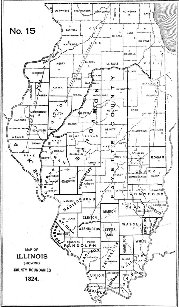
CLAY. Dec. 23--From the intersection of the line dividing ranges four and five east with the middle line of town two north; thence east with said line to the Fox River; thence north with said river to the line dividing towns five and six north; thence west with said line to the range line dividing four and five east; thence south with said range line to the beginning.
[Laws 1825, p. 19.]
CLINTON. Dec. 27--Down the Kaskaskia from the mouth of Crooked Creek to the line dividing St. Clair and Washington; thence north on the range line between five and six west to the northwest corner of town two north, five west; thence east to the southeast corner of town three north, five west; thence north to the northwest corner of town three north, four west; thence east twenty-four miles; thence south along the third principal meridian sixteen miles; thence west to Crooked Creek; thence down said creek to the beginning.
[Laws 1825, p. 27.]
WABASH. Dec. 27--From the mouth of De Bon Pas Creek up the main branch of the south line of Lawrence County; thence east to the Wabash; thence down the Wabash to the place of beginning.
[Laws 1825, p. 25.]