1816 Illinois County Formation Map
Try our genealogy search engine
1816--JACKSON, POPE, MONROE AND CRAWFORD
As counties of the Illinois Territory
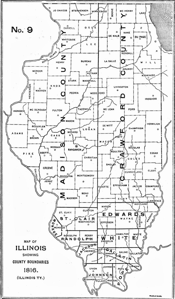
MONROE. Jan. 6--Beginning on the Mississippi River where the base line, which is about three-fourths of a mile below Judge Brigg's present residence, strikes the said river; thence with the base line until it strikes the first township line therefrom; thence southeast to the southeast corner of township two south, range nine west; thence south to the southeast corner of township four north, range nine west; thence southwestwardly to the Mississippi, so as to include Alexander McNabb's farm, and thence up the Mississippi to the beginning shall constitute a separate county, to be called MONROE.
[Territorial Laws, 1815-16, p. 25.]
JACKSON. Jan. 10--Beginning at the mouth of the Big Muddy River and running up the same to the township line between ten and eleven; thence east with said line to the principal meridian line running from the mouth of the Ohio River; thence north with the meridian line thirty miles; thence west twenty-four miles to the corner of range between four and five west of the principal meridian line; thence south six miles to the township corner between six and seven; thence to the headwaters of the creek called Gagnic and down it to the Mississippi; thence down the Mississippi to the beginning shall be a separate and distinct county and called and be known by the name of JACKSON.
[Territorial Laws, 1815-16, p. 62.]
POPE. Jan. 10--Beginning on the Ohio River where the meridian line leaves it that divides ranges number three and four east of the third principal meridian; thence north to the township line dividing townships ten and eleven south; thence east eighteen miles; thence to that point on the Ohio where the line dividing ranges eight and nine leaves it; thence down the same to the beginning shall constitute a separate county, to be called and known by the name of POPE.
[Territorial Laws, 1815-16, p. 66.]*
CRAWFORD. Dec. 31--Beginning at the mouth of the Embarras and running with said river to the intersection of the line dividing townships number three and four north, of range eleven west, of the second principal meridian; thence west with said township line to the meridian and due north until it strikes the line of Upper Canada; thence to the line that separates this territory from the state of Indiana; and thence south with said dividing line to the beginning shall constitute a separate county, to be called CRAWFORD.
[Territorial Laws, 1816-17, p. 21.]
*NOTE--The northeastern line of Pope County was changed by act of Dec. 26, 1816, and established as follows: "Beginning at Rock and Cave [Cave-in-Rock] on the Ohio River; thence a straight line to the corner of townships number ten and eleven south and ranges number seven and eight, east of the third principal meridian."
[Territorial Laws, 1816-17, p. 10.]