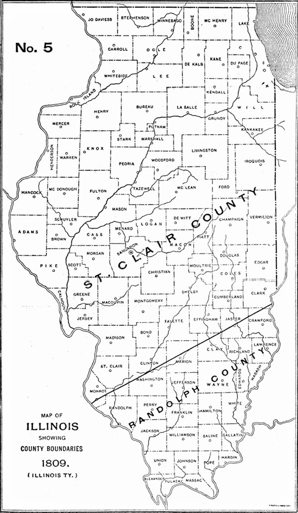
1809 Illinois County Formation Map
Try our genealogy search engine
1809--ST. CLAIR AND RANDOLPH
As counties of the Illinois Territory
A PROCLAMATION BY NATHANIEL POPE, SECRETARY OF THE TERRITORY OF ILLINOIS AND EXERCISING THE GOVERNMENT THEREOF
By virtue of the powers vested in the governor for the prevention of crimes and injuries and for the execution of process civil and criminal within the Territory; I have thought proper to, and by this proclamation do, divide the Illinois Territory into two counties to be called the COUNTY OF ST. CLAIR and the COUNTY OF RANDOLPH. The county of Randolph shall include all that part of the Illinois Territory lying south of the line dividing the counties of Randolph and St. Clair as it existed under the government of the Indiana Territory on the last day of February in the year one thousand eight hundred and nine. And the county of St. Clair shall include all that part of the Territory which lies north of said line.
Done at Kaskaskia, the 28th day of April, 1809, and of the Independence of the United States the thirty-third.
NAT. POPE.
[Territorial Records of Illinois, p. 3.]