1803 Illinois County Formation Map
Try our genealogy search engine
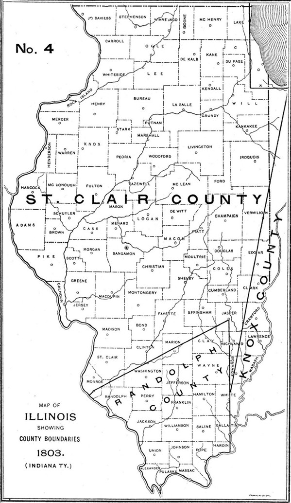
1803--ST. CLAIR AND RANDOLPH
As counties of the Territory of Indiana: boundaries changed
JANUARY 24, 1803: Alteration by proclamation forming Wayne County, Indiana Territory, effective upon admission of Ohio to the Union.
BOUNDARY CHANGE: By the proclamation of January 24, 1803, that part of St. Clair County lying north and east of a line beginning at "the Southerly Extreame of Lake Michigan," running thence due west until it "would intersect a North and South line passing through the most westerly bend of the said Lake, and thence north along the last mentioned line to the Territorial Boundary of the United States," was transferred to Wayne County. Territorial Executive Journal, 115.
MARCH 25, 1803: Alteration by proclamation extending Randolph County, effective May 1, 1803.
BOUNDARY CHANGE: "The line seperating the Counties of Randolph and St. Clair shall begin on the Mississippi River four miles and thirty two Chains south of the point, where the present division line intersects the Mississippi Bottom, thence by a direct line to the Sink hole Springs, thence by a line north sixty degrees East until it intersects a north line running from the great Cave on the Ohio River." Territorial Executive Journal, 118.