1801 Illinois County Formation Map
Try our genealogy search engine
1801--ST. CLAIR AND RANDOLPH
As counties of the Territory of Indiana
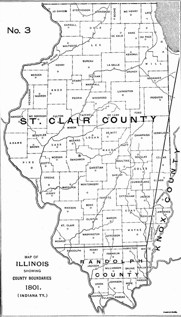
February 3--The Governor issued a proclamation altering the boundary lines of the counties of Knox and Randolph and St. Clair as follows, to wit: The boundary of the county of RANDOLPH shall begin on the Ohio River at a place called the Great Cave below the Saline Lick, thence by a direct north line until it intersects an east and west line running from the Mississippi through the Sink Hole spring, thence along the said line to the Mississippi, thence down the Mississippi to the mouth of the Ohio, and up the Ohio to the place of beginning.
The county of ST. CLAIR shall be bounded on the south by the before mentioned east and west line running from the Mississippi through the Sink Hole spring to the intersection of the north line running from the Great Cave aforesaid, thence from the said point of intersection by a direct line to the mouth of the great Kennoumic River falling into the southerly bend of Lake Michigan, thence by a direct northeast line to the division line between the Indiana and Northwestern Territories, thence along the said line to the Territorial boundary of the United States and along the said boundary line to the intersection thereof with the Mississippi, and down the Mississippi to the place of beginning.
[Executive Journal of Indiana Territory, p. 98.]